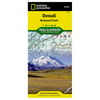
Denali National Park and Preserve (National Geographic Trails Illustrated Map) - National Geographic

Denali National Park and Preserve (National Geographic Trails Illustrated Map) - National Geographic
(1)
1 stores
0 Products

Product Details

Waterproof, Tear-Resistant, Topographic Map, This Trails Illustrated Topographic Map For Denali National Park In The Alaska Range, Crowned By Mounty Mckinley, Which At 20,320 Feet Is America'S Highest Peak. The Map Includes The Entire National Park Area, With A Close Up View Of The Area In An Around Mount Mckinley. It Also Includes Information About Denali National Park And Preserve, As Well As Useful Tips About Animal Encounters, River Crossings, Hypothermia, And More.Includes Utm Grids For Use With Your Gps Unit.

Shop Now

Compare Buying Options

Search
Amazon Amazon

Product Specifications

Technical Details

Manufacturer -
Brand National Geographic
Item model number -
Color -
Weight -
Height -
Depth -

Additional Product Information

Product Id 1474529
User Reviews and Ratings
3 (1 ratings)
3 out of 5 stars
UPC 749717002227

Shopping Options

Compare Buying Options

# Shop & Price
1
Check on Amazon
Price:
Search Visit Amazon

Top User Reviews and Ratings

No reviews available yet.

Be the first to review this product!