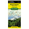
Mount Rainier National Park (National Geographic Trails Illustrated Map) - National Geographic

Mount Rainier National Park (National Geographic Trails Illustrated Map) - National Geographic
Model: 217
(1)
1 stores
0 Products

Product Details

Within The Park, There Is Detailed Coverage Of Mount Rainier And Its Many Glaciers, Eagles Roost, Cataract Valley, Mystic, Emmons Overlook, Indian Bar, Maple Creek, Snow Lake, Paradise River, Jackson, And Many Other Camping Areas. A Detailed Inset Gives You A Close-Up View Of The Peak And Trails Leading To Its Glaciers . The Trails Have Been Enhanced And Road And Trail Mileage Have Been Added To Create A More Usable Map. Utm Grids Have Also Been Added To Make It More Usable With Your Gps. Approximately 4.25'' X 9.25'' Folded; 26'' X 38'' Fully Opened Scale = 1:100,000.

Shop Now

Compare Buying Options

Search
Amazon Amazon

Product Specifications

Technical Details

Manufacturer -
Brand National Geographic
Item model number 217
Color -
Weight -
Height -
Depth -

Additional Product Information

Product Id 1474516
User Reviews and Ratings
3 (1 ratings)
3 out of 5 stars
UPC 749717002173

Shopping Options

Compare Buying Options

# Shop & Price
1
Check on Amazon
Price:
Search Visit Amazon

Top User Reviews and Ratings

No reviews available yet.

Be the first to review this product!