
BestPeek

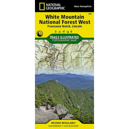
National Geographic Trails Illustrated Topographic Map White Mountains National Forest West Franconia Notch, Lincoln, New Hampshire - Folded Map
3.0
1 Reviews
$13.89 starting price
In Stock | 1 stores
Available from 1 stores
Amazon
Check on Amazon
Amazon
walmart
$13.89
Walmart

Product Description

- Waterproof - Tear-Resistant - Topographic Map National Geographic's Trails Illustrated map of White Mountain National Forest West provides unparalleled detail for outdoor enthusiasts seeking to enjoy the year-round recreational opportunities the park has to offer. Expertly researched and created in partnership with local land management agencies including the Appalachian Mountain Club, this map includes helpful contact information, safety tips, and more. The map features many key areas of interest including Presidential Range-Dry, Pemigewasset and Sandwich Range Wilderness, Connecticut River and White Mountain Trail Scenic Byways, Kancamagus Highway, Appalachian Trail, Squam Lake and Mount Washington. This map will prove invaluable in your exploration of the park, with its clearly marked trails, including miles of the Appalachian Trail that traverses the forest. All the trails are marked with mileage indicators, lookout points, shelters and other significant points of interest. The map base includes contour lines and elevations for summits, passes and many lakes. With many scenic byways noted, the map can guide those wishing to take in the scenery by car. Recreation features are clearly marked as well, including campgrounds, trailheads, interpretive trails, skiing, fishing, boating and swimming areas, waterfalls, scenic overlooks, and more. Every Trails Illustrated map is printed on "Backcountry Tough" waterproof, tear-resistant paper. A full UTM grid is printed on the map to aid with GPS navigation. Other features found on this map include: Hanover, Knox Mountain, Montalban Ridge, Moose Mountain, Mount Franklin, Mount Lafayette, Mount Lincoln, Mount Monroe, Mount Moosilauke, Mount Tecumseh, Mount Washington, Ossipee Mountains, Pemigewasset Wilderness, Presidential Range, Presidential Range-Dry River Wilderness, Red Hill, Sandwich Range Wilderness, South Twin Mountain, Squam Lake, White Mountain National Forest, White Mountains. Map Scale = 1:70,000 Sheet Size = 25.5" x 37.75" Folded Size = 4.25" x 9.25"

Shopping Options

Product Details

Rating
3.0
1 Reviews
Status
In Stock
1 stores
Category
-
ID
299259

Technical Details

Manufacturer
National Geographic
Brand
National Geographic
SKU
WM-749717011540
UPC
749717011540
Color
White

Customer Reviews

3.0

No reviews available yet

Be the first to share your experience!

Frequently Asked Questions

What is the lowest price for National Geographic Trails Illustrated Topographic Map White Mountains National Forest West Franconia Notch, Lincoln, New Hampshire - Folded Map?

As of today, the lowest price for National Geographic Trails Illustrated Topographic Map White Mountains National Forest West Franconia Notch, Lincoln, New Hampshire - Folded Map is $13.89. We compare prices from multiple online stores to help you find the best deal.

Is National Geographic Trails Illustrated Topographic Map White Mountains National Forest West Franconia Notch, Lincoln, New Hampshire - Folded Map currently in stock?

Yes, National Geographic Trails Illustrated Topographic Map White Mountains National Forest West Franconia Notch, Lincoln, New Hampshire - Folded Map is currently in stock at 1 stores. You can find detailed information in our price comparison table above.

Where can I buy National Geographic Trails Illustrated Topographic Map White Mountains National Forest West Franconia Notch, Lincoln, New Hampshire - Folded Map?

You can purchase National Geographic Trails Illustrated Topographic Map White Mountains National Forest West Franconia Notch, Lincoln, New Hampshire - Folded Map from several major retailers. We recommend checking the price comparison above to ensure you get the best deal.