
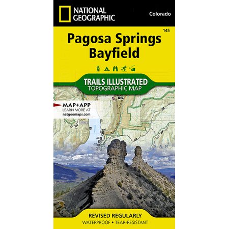
National Geographic Maps: Trails Illustrated: Pagosa Springs, Bayfield - Folded Map

3.0
1 Reviews
$14.95
starting price
In Stock
|
1 stores
Available from 1 stores

Check on Amazon
Amazon

$14.95
Walmart
Product Description
- Waterproof - Tear-Resistant - Topographic Map National Geographic's Trails Illustrated map of Pagosa Springs and Bayfield provides unparalleled detail of this area on the western slope of the Continental Divide in southwestern Colorado. Expertly researched and created in partnership with the U.S. Forest Service, Southern Ute Indian Tribe, Bureau of Land Management and others, the map's coverage includes San Juan National Forest, Piedra Area and River, Vallecito and Lemon Reservoirs, Chimney Rock National Monument and Southern Ute Indian Reservation. Get off the beaten path and back on again by following the map to trailheads and then along trails that are labeled according to their designated usage. High clearance and four-wheel drive roads are marked as well. To aid in your navigation, the map includes contour lines, elevations, labeled peaks, water features, waypoints, and clear boundaries between national park and Indian land, which is closed to the public for recreational purposes. Many recreation points of interest, for all seasons, are clearly noted, including campgrounds and campsites, cross-country ski areas and snowmobile trails, boat launch and river access points, fishing areas, scenic viewpoints and wildlife viewing areas. In addition, the map provides background information of the area, survival tips and contact information of both public and private organizations involved in maintaining the region. Every Trails Illustrated map is printed on "Backcountry Tough" waterproof, tear-resistant paper. A full UTM grid is printed on the map to aid with GPS navigation. Other features found on this map include: Mesa Mountains, Navajo River, San Juan National Forest, Vallecito Reservoir, Weminuche Wilderness. Map Scale = 1:63,360 Sheet Size = 25.5" x 37.75" Folded Size = 4" x 7.5"
Shopping Options
Product Details
Rating
3.0
1 Reviews
Status
In Stock
1 stores
Category
-
ID
299272
Technical Details
Customer Reviews
3.0
No reviews available yet
Be the first to share your experience!
Loading reviews...
Frequently Asked Questions
What is the lowest price for National Geographic Maps: Trails Illustrated: Pagosa Springs, Bayfield - Folded Map?
As of today, the lowest price for National Geographic Maps: Trails Illustrated: Pagosa Springs, Bayfield - Folded Map is $14.95. We compare prices from multiple online stores to help you find the best deal.
Is National Geographic Maps: Trails Illustrated: Pagosa Springs, Bayfield - Folded Map currently in stock?
Yes, National Geographic Maps: Trails Illustrated: Pagosa Springs, Bayfield - Folded Map is currently in stock at 1 stores. You can find detailed information in our price comparison table above.
Where can I buy National Geographic Maps: Trails Illustrated: Pagosa Springs, Bayfield - Folded Map?
You can purchase National Geographic Maps: Trails Illustrated: Pagosa Springs, Bayfield - Folded Map from several major retailers. We recommend checking the price comparison above to ensure you get the best deal.
![National Geographic Trails Illustrated M Salt River Canyon Map [Tonto National Forest], Book 853, (Paperback)](https://i5.walmartimages.com/asr/3848260e-ba72-4bd8-85a1-17563f3cdae6.e757a7ea901e12dc636ffbfbdbc7bcf6.jpeg?odnHeight=180&odnWidth=180&odnBg=ffffff)






![National Geographic Maps: Trails Illustrated: Mogollon Rim, Munds Mountain [apache-Sitgreaves, Coconino, and Tonto National Forests] - Folded Map](https://i5.walmartimages.com/seo/Aitoh-Chiyogami-Paper-Pack-Package-of-40-Assorted-Sheets_2714bd12-2ae8-4e60-961a-d116400ce7c3.12216a0f0b0894b04b24a64a92868ab1.jpeg?odnHeight=450&odnWidth=450&odnBg=FFFFFF)